Pilot Knob
Pilot Knob
DeWitt County, Texas
28 54.953' N 97 36.482' W
Directions: Start at the intersection of Nordheim Cemetery Road and CR-229. The cemetery is on the southeast corner of the intersection.
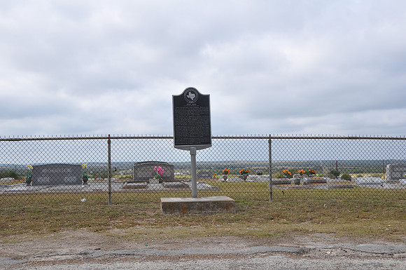
Text: A beacon for early Texas pioneers. Because this hill could be seen for miles, it guided travelers from Old Indianola (on the coast) inland to Helena and San Antonio during the 19th century. On the hill, they discovered charred rocks and artifacts from a previous Indian campground. The area was first surveyed in 1838 by the Goliad Land District and in 1886 the San Antonio and Aransas Pass Railroad was built through this region. For years a sign at the Weldon Switch (present Nordheim) Depot proclaimed its 400-foot elevation was highest on the line between Houston, San Antonio, and Waco. In 1895 Nordheim was platted. Afterward numerous German immigrants were attracted to the area. Under the sturdy oaks on Pilot Knob, young and old enjoyed typical German and pioneer activities, including band concerts, shooting matches, harvest and May festivals, and Easter egg hunts. A refreshment stand and dance platform were built on the hill, which became the center of social life for Nordheim citizens. Here the townspeople also buried their dead, and since most activities had been moved into town by about 1910, Pilot Knob gradually settled into its present use as the community cemetery.